Northern concerns seem to have been heard in the newly released Manitoba electoral map.
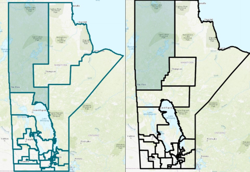
The map contains changes from both the previous electoral district map and the proposed map released earlier this year by the Manitoba Electoral Divisions Boundaries Commission (MEDBC). With the new map, Flin Flon and The Pas will stay in separate ridings instead of being combined, as suggested in the previous proposed map.
The new Flin Flon riding extends from just south of Cranberry Portage to Manitoba’s northern border with Nunavut, including a portion that stretches east to include Norway House and Cross Lake and south to the northern shore of Lake Winnipeg. Communities near Flin Flon, including Snow Lake, Sherridon and Pukatawagan, remain in the Flin Flon riding, along with far northern communities like Brochet, Lac Brochet, Leaf Rapids, Lynn Lake and Tadoule Lake.
Five ridings will include northern areas, the same as the previous electoral map. The Thompson riding will now include Churchill, Gillam and Nelson House. The Pas will now be the anchor for a new riding, named The Pas-Kameesak, stretching from Cormorant and Wanless south through the Interlake area to Peguis and Fisher River. The Keewatinook riding will extend from Port Nelson on Hudson Bay down to Fort Alexander in southeastern Manitoba. The fifth riding representing northern areas is the Swan River riding, which goes as far north as Dawson Bay, between The Pas and Mafeking.
According to a report released last week by the MEDBC, these ridings “will now essentially encompass most of the Crown lands of Manitoba or, put another way, the lands that have not been surveyed into townships.”
The first map proposal was controversial following its release, both for combining The Pas and Flin Flon and for reducing the number of northern Manitoba ridings from five to four while increasing the number of ridings within Winnipeg by one. At a public meeting held by the MEDBC in Flin Flon in September, Flin Flon mayor Cal Huntley, MLA Tom Lindsey and other prominent locals made presentations opposing the proposed map.
In the newly released report, the MEDBC said there was a “significant population imbalance” between the previous Flin Flon and The Pas ridings and that the issue would be addressed in the new map. All northern ridings were below the provincial population threshold, with the Flin Flon riding containing the fewest people of any Manitoba riding. Now, each of the ridings is above the threshold.
“Under the new boundaries, the electoral divisions in the north have better balanced populations, are more similar in size and respect travel patterns as well as communities of interest,” the new report said.


